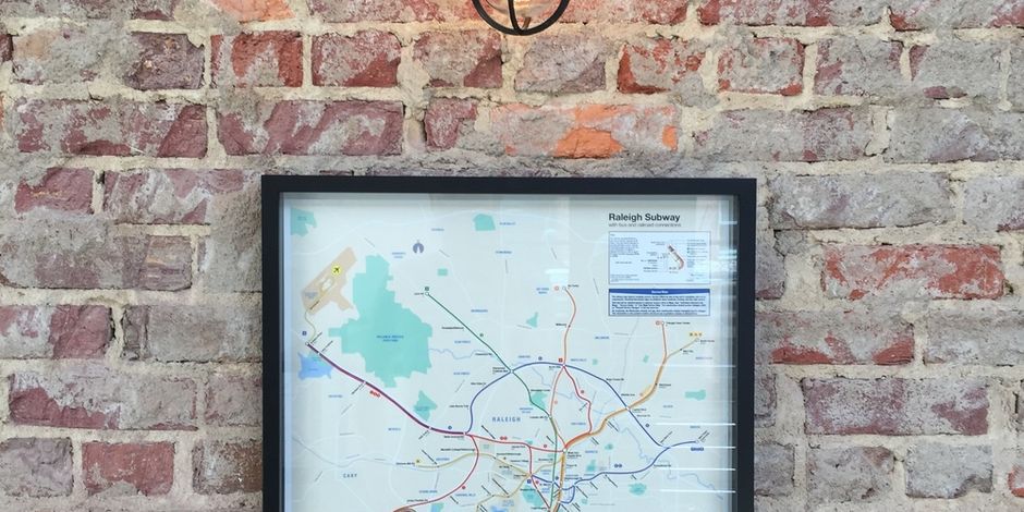
Raleigh City Subway

Raleigh City Subway was a project that I began when I moved back to North Carolina from NYC. I had moved to New York City with the expectation of living there and starting a career, but a friend of mine invited me to help him start a company in Raleigh, and I couldn't turn the offer down.
When I moved to Raleigh, I realized I would miss a couple of things about NYC, namely, the beautiful subway map. Whenever you need to go somewhere in NYC, you always refer to one map. Everyone knows it, and everyone recognizes it. So I thought: "I wish there was a map of Raleigh that everyone knew, recognized, and referred to. Even if it's fictional."
I started designing a rough draft of a map of Raleigh, as if Raleigh had a subway system similar to NYC. My idea for this map is that it would make me feel like I'm in a big city, where lots of things are happening at each stop, and there are reasons to go to each station and explore. My hope is that after I moved back to Raleigh, I wouldn't miss anything that I'd gotten so used to in New York.
The subway map that I designed borrows graphic elements from the New York City Subway System. It is also meant to spark public interest and awareness in public transit systems, something that Raleigh could deeply benefit from as it grows and changes over the next 5 years.
My hope for this map is that venues, restaurants, offices, and co-working spaces across Raleigh will display this map and that it will serve as a visual and geographic reference guide to the people of Raleigh. I foresee people joking that they live close to the Trailwood stop on the 'A' line, or that they're taking the 'N' line to Atlantic Ave. This kind of geographic awareness serves a community by bringing people together around a common understanding of geography and culture.
I foresee a decent amount of interest in these maps, but most of all, I'd like them to be on display in venues, restaurants, and offices in Raleigh.